Blog Image

PannageMan

About this blog

An occasional blog about commons, village greens and rights of way. New posts will be tweeted at @PannageMan. Any views expressed here entirely my own. Full index to blogs: http://www.craddocks.co.uk/pannageman/index.htm.

We’re all in this together?

Rights of Way Posted on Tue, 19 May 2015 21:34

The south-east regional newsletter of the Ramblers carried this short article in 2014, with the highlighted passage about Tenchleys Lane, a claim for a bridleway on the Surrey/Kent border near Limpsfield Chart made by the British Horse Society.

A disinterested bystander might reasonably assume that all organisations promoting the use of rights of way in the countryside would be equally trenchant in promoting claims to record rights of way previously omitted from the definitive map and statement (the official record of such things). And in the sense that the Ramblers, the British Horse Society, the Trail Riders’ Fellowship and others all bring such claims, the bystander’s assumption would be correct. But as the article demonstrates, they are often on opposing sides to the determination of a particular claim.

Every claim which appears to be duly made and well-founded is (eventually — reaching this stage can take decades in some areas) publicised and representations can be made by anyone, including landowners, occupiers and other user groups. Where, as in the case of Tenchley’s Lane, the claim is entirely built on historical evidence (in other words, there is no current use to support the claim, but historical records are said to show that the claimed route was a highway of a certain status), objections will carry weight only to the extent that they add to or inform the interpretation of the evidence: a submission which for example, puts a different, weaker gloss on one piece of evidence, or new evidence which tends to negate the claimant’s. So representations that the way would be unsuitable for motor vehicles, or carriages, or horses, are irrelevant, unless there is evidence that the way was simply incapable of accommodating such users.

And when a user group (or indeed anyone else) submits a claim, it is quite common for a user group with different interests to object, and to seek to secure the rejection of the claim, or to promote the determination of the claim with different rights, typically to exclude motor vehicles, carriages or horse riders, but sometimes to show that ‘higher’ rights exist beyond those claimed.

It is unsurprising if user groups are alert to ensure that a claim does not under-record the rights on a particular route. Good research should ensure that any claim correctly reflects the supporting evidence, but PannageMan suspects that claims may occasionally be made by, say, walkers for footpaths or bridleways, where the evidence better suggests a restricted byway or byway open to all traffic, either because the claim might meet less resistance or because the claimants would resent the intrusion of vehicles consequent on the determination of the claim to confirm higher rights. In other words, ‘we’re going to claim this old road, but we want it only for [walkers][horse riders][horse-drawn carriage drivers] and not for [horse riders][horse-drawn carriage drivers][motorists]’ (substitute as appropriate).

A source close to PannageMan can reveal that half of New Years Day 2014 was dissipated in writing a rebuttal of an objection from the Ramblers to the claim for Tenchley’s Lane. The objection surprised PannageMan, because much of the claimed route was entirely ‘new’, comprising a sunken lane not recorded on the definitive map, running south off Limpsfield Chart down to Itchingwood Common. Another part lay along an existing drive. But a key part was coincident with what was recorded as a public footpath: a steep climb uphill along a modestly narrow path between fences. It was perhaps the last which had stimulated the objection, owing to concern about horses and pedestrians sharing the same path — although this is common enough elsewhere, there are far narrower bridleways even in Surrey, and people and horses get by (literally). Had the claim been successful, the width of the claimed lane ought to have required the close-set fences to have been set back, giving everyone more space.

The claim was rejected by the Planning Inspectorate, as the historical evidence was found just insufficient. The Ramblers’ objection was not the only objection, nor was it necessarily material in deciding the claim. But the outcome is that there is less access than there might have been for walkers, horse riders and cyclists, and volunteers’ time is spent unproductively on depreciating each others’ work. And one is left wondering whether user groups are most effective when they are engaged in sniping at each other, rather than in promoting more and better access for all. Is this what an ‘important victory’ should look like for a user group?


Bradley Lane or Bradley Path?

Rights of Way Posted on Thu, 26 February 2015 21:43

Trail Riders Fellowship v Secretary of State for the Environment, Food and Rural Affairs is a judgment of the High Court given in January in a challenge concerning what is often known as an ‘unclassified county road’ (UCR). The UCR in question is a country lane in Derbyshire, Bradley Lane, which runs between the village of Pilsley and the A619 in the valley below, 60 metres lower down. You can see the lane on the Ordnance Survey Explorer Map here, marked with green dots as ‘other routes with public access’ (ORPA), in the photograph below, and on Geograph here: 1, 2 and 3.

Bradley Lane: © Andrew Hill and licensed for reuse under this Creative Commons Licence

Bradley Lane was originally recorded on the definitive map and statement as a ‘Road used as Public Path’ (RUPP), a fix adopted by the National Parks & Access to the Countryside Act 1949 to record public ways in the countryside which appeared also to be used by vehicles. RUPP status allowed the way to be recorded as available to walkers and horse riders without any need for corroboration of public vehicular rights. Bradley Lane was more unusual, in that, long before it was captured on the definitive map as a RUPP, it was maintained by the former Bakewell Rural District Council as one of its local ‘roads’, and when responsibility for maintenance was formally transferred to Derbyshire County Council under s.30 of the Local Government Act 1929, Bradley Lane was shown on its ‘handover map’ as an ‘unscheduled other district road’, or what was to become known among the initiated as an UCR — a road which was of such lowly class that it was neither distinguished with a classification number, nor tarred during those years after the Great War when most public roads were given a sealed surface.

Strictly speaking, what was handed over at that time was responsibility for all publicly maintainable highways which were not already vested in the county council, including most footpaths and bridleways. But what both councils were really interested in was the extent of the road network, and the liability to maintain which was transferring from one to the other. So the rural district councils drew up handover maps, on which were marked in colour all the minor highways recognised as being maintainable at that time, sometimes distinguishing those which were tarred and those which were not. It follows that, because the transfer was not confined to minor roads, it cannot be concluded with any certainty that highways marked on the handover maps were carriageways: i.e.with a right of way for motor vehicles. But that seems generally to have been the intention, even if the maps represented no more than the experience and assumptions of the rural district council’s highways officer.

This court challenge sought to overturn the decision of an independent inspector, determining a definitive map modification order, to show Bradley Lane as a public bridleway (you can see the interim and final decision, including maps, on the planning portal, scrolling down for case reference FPS/U1050/7/66). The application for the order had been made by a member of the Trail Riders’ Fellowship, seeking to show the lane as a byway open to all traffic (BOAT). But the inspector, reviewing the historic evidence of status, concluded that there was insufficient evidence of vehicular rights, and (following two public inquiries) downgraded the outcome of the order to bridleway. The Fellowship was aggrieved, perhaps less because they disagreed with the inspector’s interpretation and balancing of the evidence (though they undoubtedly did), but more because their starting point was that, as a UCR with the history described above, that should strongly weigh the balance in favour of rights for vehicular use.

It is not hard to sense the Fellowship’s frustration with the inspector’s decision, and imagine that it will be still less happy with the court’s judgment. Much of the evidence for vehicular rights was circumstantial: the inclusion on the handover map, the exclusion from the first definitive map (presumably because Bradley Lane was then thought to be a road not appropriate for inclusion), the subsequent designation as a RUPP rather than a bridleway. And in each of those cases, the court concluded that the evidence could point either way. It was right about that — but they were all strong pointers in one direction. The judgment does not in itself affect the status of UCRs nationally. But it does undermine the expectation that most such UCRs, at least in the countryside, are carriageways, even if evidence is sometimes lacking. However, an expectation is all it ever was, and all it can be. Given that some UCRs are pretty certainly not carriageways, there can be no presumption that any particular UCR is one, for one can only assess the probability that a particular UCR is a carriageway, rather than draw a conclusion in a particular case on the basis of probability alone.

Counsel for the Fellowship had a go at undermining the inspector’s decision on the evidence, but in a challenge of this kind, it is not enough to convince the court that it might have arrived at a different conclusion: it is necessary to show that there was some error of law or irrationality. There was an attempt to assert that the expression ‘lane’ (in the name of the route, ‘Bradley Lane’) itself indicated a carriageway: there was some support for this approach in case law. But the court was unimpressed, and again, it seems the best that can be said is that a lane very often is a minor road running between two other roads — but not that it inevitably is so. (It is not hard to find exceptions, although an exception today may not necessarily have been an exception in the past.)

There was also some discussion of plans for the Manchester, Buxton, Matlock and Midlands Junction Railway. Such plans are often used in rights of way claims. A company proposing to build a railway needed a private Act of Parliament, and standing orders of Parliament required that the company must deposit, in addition to a Bill, plans of the proposed line and books of reference containing details of the land which might be acquired. Particularly during the years of ‘railway mania’ in the middle of the nineteenth century, many lines were proposed which never saw the light of day, but which progressed far enough to be deposited with Parliament, even if the Bill were thrown out, or the company withdrew (perhaps bought out by a competitor). In this case, the railway was clearly not built, but although the evidence is unclear, it appears that an Act for the railway was in fact given Royal Assent in 1848 (c.cxcii here). It may be that the plans were approved by Parliament, but perhaps the specific proposals for a line over Bradley Lane were withdrawn from the Bill. The inspector concluded that, “the railway was not pursued in this locality. This limits the weight that can be given to these documents.” The court agreed, and said, “Nevertheless, the plans were never put before Parliament and so there was no detailed consideration of the issue.” Either way, the comments are unhelpful: what mattered is that, regardless of the outcome, there was an extensive process of local survey and what today would be called consultation with owners, tenants and parish authorities, carried out by experienced surveyors, to inform the deposited plans. Whether, in fact, the line was built, or indeed, whether the plans were endorsed by Parliament, is very much a secondary issue, but on the face of it, the inspector, and the court, were too quick to dismiss the evidence.

The residents of Pilsley, and walkers and horse riders, may be delighted with the outcome of the order, and the failure of the court challenge, and it is impossible to say that either was in error. But one comes away with the sense that it could easily have been a different outcome, given a more sympathetic hearing from the inspector. Look again at the photograph above, and you’ll see, even today, a reasonably wide lane capable of accommodating a car: is it likely that such a way would not have been used by horse drawn carriages? That is at the heart of this case.


Up the garden path

Rights of Way Posted on Thu, 29 January 2015 21:47

Powell and Irani v the Secretary of State for Environment, Food and Rural Affairs and Doncaster Borough Council is a rather technical but ingenious case recently decided by the High Court, which merits some comment here.

The case concerns a public footpath which formerly passed through the grounds of the vicarage at Hatfield church, Doncaster. You can see the location on Streetmap.co.uk and in Google Maps. In 1967, the path was formally diverted to an alternative route around the outside of the grounds: an alleyway in effect (visible in the Google Maps photography). But the original route, just 30 metres long, continued to be used, more so once the gate and stile at respective ends of the path became broken down and ceased to be an obstacle to passage, until in 2006 development of the old vicarage grounds began, and the original route became obstructed. Eventually, in 2012, the surveying authority, Doncaster Borough Council, made an order to recognise that the formerly extinguished footpath had come into being once again through twenty years’ use ‘as of right’ — just as can happen through long use of any path. In due course, following a decision by an inspector which was quashed in the High Court, the order was again referred to a public inquiry presided over by another rights of way inspector, who heard evidence of the use, found that there had indeed been long use ‘as of right’, and confirmed the order (see the inspector’s decision letter and map).

The claimants, who were now owners of 6 Vicarage Close, the relevant bit of the old grounds, did not in court dispute that there had been sufficient qualifying use of the former footpath. But (and this is where the ingenuity comes in) they did challenge the council’s order as not in accordance with the law.

Now, all existing rights of way are required to be shown on a definitive map and statement kept by the surveying authority. Until 1981, the authority was required to review the map every five years and update it as necessary. Subsequently, under s.53 of the Wildlife and Countryside Act 1981, the authority was required to modify the map to reflect (among other things) legal events, such as the diversion order. In neither case did the authority act on the 1967 order, so the definitive map continued to show the former footpath (and did not show the diverted path). In itself, that failing did not greatly matter: the definitive map must be read alongside any legal events which have not been recorded on it, and Doncaster’s failing was not unusual. Taken together, the map and the 1967 order were quite sufficient evidence of the effect of the diversion.

The 2012 order was made under s.53(3)(c)(i) of the 1981 Act. This required Doncaster to make the order (a definitive map modification order) on: “the discovery by the authority of evidence which…shows—(i) that a right of way which is not shown on the map and statement subsists or is reasonably alleged to subsist over land…”. That is the usual test for an order to add a path to the map following long use. But the challenge in this unusual case was that the claimed footpath was shown on the map and statement. True enough that what was shown on the map was no longer extant: it was accepted that the footpath through the garden had been legally extinguished. But in the strict terms of the legislation, which understandably failed to anticipate such a scenario, the order could not be made to add a right of way to the map which already existed on the map (albeit the map was out-of-date). In its judgment, the court more or less acknowledged the strict legal merits of this argument, but found it didn’t need to grant relief on the strength of it, because the order could have been made under s.53(3)(b) instead, which enables an order to be made on: “the expiration…of any period such that the enjoyment by the public of the way during that period raises a presumption that the way has been dedicated as a public path…”. The court was not prepared to quash the order as incapable of having effect under one provision if the order could have been resurrected in similar form under the alternative provision (after, needless to say, the expenditure of further public funds).

The claimants also argued that the use of the path was not ‘as of right’ because a landowner, noting that the path was shown on the definitive map, would assume that the use was ‘by right’ (i.e. the public had an absolute right to use it), even though proper inquiry would have revealed the map to be erroneous. It was suggested that, in determining whether use was ‘as of right’, the inspector had to consider not only whether use was ‘without force, without secrecy and without permission’, but also whether it was reasonable for the landowner to have resisted use which had the appearance of being lawful (rather than trespass). In fact, the claimants admitted that there was no evidence that they, or any landowner, had been misled in that way. The major part of the judgment is devoted to reviewing the claimants’ analysis, taking the reader through some of the classic judgments on town and village green law in the House of Lords and Supreme Court (greens are also registered on the basis of use ‘as of right’). But in the end, it was the judgment in the Court of Appeal in London Tara Hotel Ltd v Kensington Close Hotel Ltd which best summarised the law. The Tara had licensed the then owner of the Kensington Close to use a roadway over the Tara’s land, but the Kensington Close had subsequently changed hands causing the licence to cease to have effect. The Tara hadn’t really sparked on the change of ownership, but did nothing to stop continued use of the roadway. The court noted the appellant’s argument that the Tara: “could be said to have proceeded on the assumption that things were continuing as they had before 1980, and so, implicitly, that the Licence still applied, and the use was with permission…[the Kensington Close’s] predecessors did not inform Tara of the change in the KC Hotel’s ownership, which meant that the subsequent use of the roadway was, from the perspective of Tara, secret”. But the court recognised there had been no deliberate secrecy, and even junior Tara staff knew of the change of ownership. In the event, the Kensington Close established a private easement over the roadway on the basis of 20 years’ use as of right after the cessation of the the licence. The court said that: “The subjective state of mind of the owner is…irrelevant”, and declined to graft some additional test of how the use might have appeared to the landowner, and whether it was reasonable for the landowner to object to the use, onto the tripartite elements of use ‘as of right’. And so in Powell, the court applied the same reasoning to decide that, whatever the appearance of the situation to the landowner, the inspector had found that the use of the path was ‘as of right’, and that was all that mattered.

Comment: The arguments of the claimants may have been ingenious, but it would have been surprising if they had won the day, for it was not claimed that anyone had been seriously misled by Doncaster’s failure to update the definitive map. Still, they came close with a challenge on the vires of s.53(3)(c)(i). The authority was in common with many other surveying authorities in devoting a low priority (or none at all?) to updating the definitive map to reflect legal events since the map was published with a relevant date of 1952, and it’s not hard to understand why, given more pressing demands on officers’ time to deliver more immediately useful outputs (such as diversion orders).

The claimants will now have to decide what to do with the public footpath across their land. Their problem is that the most obvious diversion route is already a public right of way, put in place by the 1967 diversion, so it may be that they will want to seek an extinguishment order rather than a diversion. The test for stopping up a path is notoriously more demanding than a diversion, and there is ample evidence from the inquiry that there is a latent demand to use the path. The Government’s draft guidance on the diversion or extinguishment of rights of way that pass through gardens may assist if and when it is formally published in the wake of the Deregulation Bill receiving Royal Assent in the next couple of months. With two High Court challenges and representation at a public inquiry by counsel already under their belt, it seems unlikely that the claimants will want to take it no further.


Andrews 2: anticipating the appeal

Rights of Way Posted on Sun, 16 November 2014 16:41

Andrews 2 is a pending Court of Appeal case about the eligibility of public paths made under inclosure awards in the first half of the nineteenth century. Could Inclosure Commissioners, acting under local Acts incorporating the Inclosure Consolidation Act 1801, award public footpaths and bridleways over the old common lands being inclosed (as they appear to have thought), or are those paths null and void?

The question is not an academic one: quite the opposite. Hundreds of inclosures were made under powers incorporating the 1801 Act, and most of those do contain awarded public paths. Indeed, most inclosure awards, from the eighteenth century on to the early years of the twentieth century, did set out public paths. An award is a legally conclusive document made under an Act of Parliament, so a public path set out in the award is normally conclusive proof of its existence, even now perhaps two hundred or more years later — but uniquely those awarded under the 1801 Act are claimed to be fatally flawed.

A High Court decision in 1993, R v Secretary of State for the Environment, ex parte Andrews (“Andrews 1”), decided that the 1801 Act did not contain powers to award public paths (except in certain limited circumstances), and you can read more about it in my first blog on the case. This year, a fresh challenge (“Andrews 2”) was brought to revisit the same question, with the same claimant, John Andrews, represented by the same counsel, George Laurence QC, and judgment was again given against Mr Andrews by the High Court on 8 May: more about that in my second blog.

Both judgments are well reasoned and comprehensive. They both find that the following wording of s.10 of the 1801 Act:

“And be it further enacted, That such Commissioner or Commissioners shall, and he or they is and are hereby empowered and required to set out and appoint such private Roads, Bridleways, Footways, Ditches, Drains, Watercourses, Watering Places, Quarries, Bridges, Gates, Stiles, Mounds, Fences, Banks, Bounds and Land Marks, in, over, upon, and through or by the Sides of the Allotments to be made and set out in pursuance of such Act”

must be taken at face value — that ‘private’ qualifies the entire list of features which may be awarded, and that therefore only private bridleways and private footways were within the competence of the Commissioners. This blog looks at some of the extraordinary consequences of those decisions, in anticipation of an appeal to the Court of Appeal sometime next year.

In Andrews 1, the court noted that s.11 provided for the stopping up of any existing public rights of way across the common lands or fields which were being inclosed:

“all Roads, Ways, and Paths, over, through, and upon such Lands and Grounds which shall not be set out as aforesaid, shall for ever be stopped up and extinguished”

but decided that, as the 1801 Act did not enable replacement footpaths to be ‘set out as aforesaid’, then s.11 could not extinguish existing footpaths (and impliedly bridleways) across the inclosures.

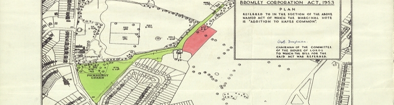
This finding, which appears to be endorsed by Andrews 2 in the High Court, is remarkable. In the days before the widespread use of motorised transport, most people travelled by foot. Some — farmers, carriers, wealthy professionals and major landowners — kept horses, and had the option to travel by horse or by horse-drawn carriage. Most did not. People made mainly local journeys: from home to the village, to the market town, to the mill, to the pump or just to neighbouring villages, hamlets or farmsteads. And because, pre-inclosure, most of the surrounding lands were open commons, they tended to take the shortest route: the land was unenclosed, uncultivated and of poor quality, many of the local inhabitants would have had rights over the common (or at least, used the common), and there was no reason why the owner, the lord of the manor, would have had any interest in trying to stop such use, for to him it had little or no productive use. Commons then were rather like land surrounding African bush villages today: a complex web of desire lines. By way of example, when the Duke of Wellington obtained an inclosure award for Riseley Common (north-east Hampshire) in 1861, the award recited no fewer than 16 public rights of way which were to be stopped up across a relatively small common about two kilometres across (see the recital in the annexe here). Had Riseley Common been inclosed under the 1801 Act, it seems that most or all of the footpaths and bridleways contained in the recital would endure today.

Whereas in the Riseley Common example, the ways to be stopped up were specifically identified in the award, the same cannot be said of most awards made under the 1801 Act, because the inferred effect of s.11 was that all public ways were to be stopped up unless specifically set out anew, and nothing more need be said. That means that it is now difficult, up to two centuries later, to identify what public paths existed prior to inclosure which endure today. But the extraordinary effect of Andrews is that they do endure: whatever the impact on the allottee, however inconvenient to the cultivation of the land, regardless of the alignment relative to the boundaries of the new allotments. Since, without any other legal process, a highway in existence pre-inclosure is a highway now, it is unlikely that any of these public paths has ceased to exist. They are rarely if ever marked on the award maps, nor is any provision made in the award or on the map to preserve their alignment across the allotments, such as to ensure that stiles, gates or gaps were provided. It is impossible to avoid the conclusion that the parties to the inclosure awards did form the view, apparently wrongly, that the old public paths were stopped up, for they did nothing to record them or ensure their preservation. Yet legally, they were not stopped up, and the complex pattern of desire lines still survives, awaiting those who can demonstrate their existence from the sparse evidence available today. Ironically, the effect of Andrews is in theory to revive far more public paths in the countryside than were ever set out in inclosure awards.

In Andrews 1, the judge commented on a submission from Mr Laurence that:

“the scheme of the Act is that all rights of way, public and private, should appear in the award and be shown on the map and that anything not thus shown is extinguished. It is an attractive submission in the sense that, if correct, it would mean that there would be a clean start for the area and everyone would know where they stood.”

The judge concluded that Mr Laurence’s inviting ‘clean sheet’ proposition could not draw him away from his interpretation of section 11, and in any case, if a clean sheet was what the parties to an inclosure wanted in any particular case, they could include additional clauses to that effect in the local Act incorporating the 1801 Act. But the evidence seen by the court was that in most cases, the parties did not do that. We know from the evidence recited in the judgment that few local Acts took specific powers to award public paths, but the judgment does not record whether significant numbers of local Acts conferred powers to stop up public paths, to plug the loophole in s.11 of the 1801 Act. It seems very likely that they did not.

Of course, it is possible, as the courts have acknowledged, that surveyors implementing inclosures after 1801 either knew that the 1801 Act was defective and ignored the defect (perhaps the local Act was a fait accompli by the time they were appointed), or they were quite unaware of the defect. Either way, it is remarkable that no-one took any steps to address the problem, most notably that solicitors promoting inclosure Bills in Parliament did not at any time include appropriate additional clauses, even after many Bills had previously passed through Parliament and been put into effect.

That is not all. The judgments find that s.10 is incapable of sustaining an award of public paths. If that is so, s.10 is also incapable of sustaining an award of any public “Ditches, Drains, Watercourses, Watering Places, Quarries, Bridges, Gates, Stiles, Mounds, Fences, Banks, Bounds and Land Marks”. Any public feature so awarded, unless supported by an enabling clause in the local Act, must also be ultra vires. It may be hard to conceive of the relevance of ‘public…fences’, but awards of public watercourses, public watering places and public quarries (typically for use of the surveyor of highways in digging for roadstone) were commonplace. None of these awards was lawful. But if so, what happens to them: do the awarded features revert to the lord of the manor, and if so, why (the lord having been amply compensated in the award as put into effect)? Must the highway authority compensate the lord of the manor for past unlawful extraction from the quarry, or must it backfill what has been extracted? Who now owns and manages those public watercourses?

Finally, in Andrews 2, the court observed:

“The landowner of the farmland in Wiltshire that is the subject of the current case has been made the Second Interested Party to these proceedings and, not unnaturally, has expressed considerable concern that, if it succeeds and a public bridleway has to be created across his land where there has been no such bridleway before, considerable interference with (and loss of profitability of) his arable farming operations would result.”

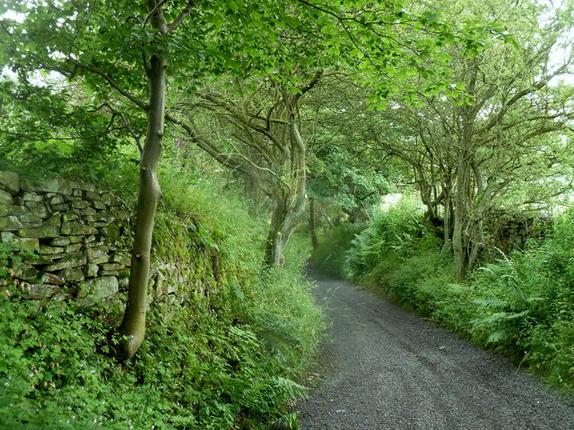
The path selected for the challenge in this case appears to have been a pure example of one which relies entirely on an inclosure award (made under the 1801 Act) for its existence — i.e. there is no history of use or more recent historical evidence for it. That ensures that the court is not distracted by ‘irrelevant’ evidence: it can focus solely on whether the inclosure award was valid. But it also has the consequence that the claim for the path appears stark, for it would, if granted, give rise to a right of way across farm land where none has apparently been recognised for two centuries. In fact, the position is not quite so stark. For the most part, a defined track along most of the awarded alignment was certainly in use: it appears as a feature on the Ordnance Survey map appended to the judgment, which appears to be the first series twenty-five inch map from 1875, and continues to appear on maps up until the 1924 six-inch map (these maps can also be viewed at old-maps.co.uk). None of these maps shows the north-west portion of the bridleway, across a field to what is now the A429. But it does appear on the Ordnance Survey’s one-inch drawing, the working draft of the first one-inch map drawn in 1817, and now kindly made available online by the British Library, even if, by the time of the published one-inch map, the north-west portion had already been removed. Not so stark after all.


Restriction on award of costs in the magistrates’ court

Rights of Way Posted on Thu, 28 August 2014 17:35

A recent High Court judgment brings welcome clarity to the power of the magistrates’ court to award costs on a ‘complaint’. A complaint is the procedure by which most civil matters are initiated in magistrates’ courts. Although the magistrates have a primarily criminal jurisdiction, they also have a role in regulating the relationship of the state, and particularly local government, with the citizen. For example, under s.91 of the Environmental Protection Act 1990, anyone (a ‘complainant’) may ask the court to make a litter abatement order against a local authority which has allowed a road to become ‘defaced’ by litter. More relevantly to this blog, the Highways Act 1980 requires the magistrates to determine an application by the highway authority to stop up or divert a highway (s.116: there are separate, more accessible, procedures specifically for rights of way, but the authority still has recourse to the court as regards any highway), while any person may apply to the court for an order requiring the authority to fix a highway out of repair (s.56), or to address an obstruction on a right of way (s.130A).

These provisions giving recourse to the magistrates’ court were conceived in a different age, when every town had its own court house and local bench of justices, and when the court fees were nominal. Now, the fee for a complaint is £205, and £720 if the complaint is contested (see para.8 of the substitute schedule contained in the schedule to the Magistrates’ Courts Fees (Amendment) Order 2014, SI 2014/875), so it hardly seems likely that the average citizen, troubled by the council’s failure to sweep a local street, will resort to the courts to oblige the council to act.

Now, s.64 of the Magistrates Courts Act 1980 provides that a complainant who obtains an order from the court may be awarded costs against the defendant (note the ‘may’): so the successful litigant may get back both legal fees and court costs — but it’s not guaranteed. But conversely, where the complaint is dismissed, s.64 enables the magistrates to award costs against the complainant: a local authority represented by counsel may easily rack up £5,000 costs preparing for and attending a half-day hearing.

But what if someone else turns up in court to have their say in relation to a complaint — an interested party? Are they able to apply for costs against the complainant, or the defendant, too? On a s.130A application (to require the highway authority to deal with an obstruction of a right of way), s.130C(6) provides that the landowner ‘responsible for the obstruction’ is entitled to be heard by the court, presumably to explain that the obstruction is not an obstruction at all, or that it is de minimis, or that the right of way is ‘seriously disputed’ (s.130B(5)(a)).

According to the judgment of the High Court in Wheeler v Norfolk County Council, the answer is ‘no’. The court said that the language of s.64 was plain: the magistrates had power to award costs to follow the event, but had no power to award costs in favour of an interested party. Collins J said: “the power is only given to make orders for costs between the parties to the case who are either complainant or defendant.” In Wheeler, the complainant had, under s.130A, sought an order against Norfolk County Council, but it had been refused, on the grounds that the obstruction had been licensed by the council under s.147 (which confers on the highway authority a power to authorise the erection of stiles or gates on a public right of way). The landowner had appeared in support of the council’s defence against the claim (and indeed, in his own self-interest: there is no criminal liability attached to an order under s.130A, but such an order, if granted, does beg the question whether a criminal offence has been committed), and sought his costs against Mr Wheeler. It seems that the magistrates were either poorly advised by their clerk, or unduly sympathetic to the plight of the landowner, but despite the language of s.64, they decided that Mr Wheeler should pay those costs.

Mr Wheeler’s victory was Pyrrhic. His s.130A complaint was dismissed by the magistrates (and not appealed). The High Court unsurprisingly declined to award Mr Wheeler costs against the magistrates, and the landowner did not appear and had obtained an assurance that he would not be held liable for those costs. So the costs of the High Court hearing were borne by Mr Wheeler, and exceeded the costs in favour of the landowner which were the subject of the appeal. Mr Wheeler still had to pay the costs of Norfolk County Council in the magistrates: over £6,000. But the judgment, albeit one in which no argument to the contrary was brought before the court other than the magistrates’ case stated, is a useful confirmation that interested parties appear before the court at their own expense. Pannageman understands that Mr Wheeler’s application was supported by the Ramblers, so he may not end up seriously out of pocket.

An interesting question now arises in an application by the highway authority to stop up or divert a highway under s.116 of the Highways Act 1980. In such an application, there is no nominated defendant, but “any person who uses the highway and any other person who would be aggrieved by the making of the order applied for, have a right to be heard” in objection to the order. Are such objectors interested parties, who are immune from an order for costs against them, or do they take on the status of defendants, who are potentially liable for costs? In the Roman Road case heard in Oxford magistrates’ court in 2007, the Ramblers and the British Horse Society were landed with a substantial five figure sum each in costs for objecting to the closure of a bridleway through a BMW factory site. They did not raise s.64 as a possible objection at the time. They may well be sorry now.

Postcript: A bit worryingly, I came across a report of Lincolnshire CC v Brewis and others ([1992] Times Law Reports, 18 August) a month or so after writing this post. In that case, the High Court held that a magistrates’ court, on a s.116 application, did have jurisdiction to award costs in favour of objectors (so in this case, it was the objectors who sought their costs against the council, the magistrates’ court having refused to make the s.116 order sought by the council). The court specifically considered s.64, and decided that an application under s.116 was indeed a complaint, but the report does not suggest the court considered the specific question of the status of objectors as defendants. Nevertheless, the case does raise further questions about the sufficiency of Wheeler as a defence to a potential award of costs against objectors to a s.116 order. So far as I can tell, Brewis was not cited to the court in Wheeler. It seems likely that a court will in due course be required to reconcile both cases in relation to a s.116 application. My money is on Wheeler.


« PreviousNext »