While we’re waiting for the High Court judgment in Andrews (see previous post: it’s now about five weeks since the hearing), the Supreme Court has decided to hear an appeal from the Court of Appeal in R (on the application of the Trail Riders Fellowship and Tilbury) v Dorset County Council and the Secretary of State for Environment, Food and Rural Affairs and Plumbe. The Supreme Court frequently hears town and village green cases, but the last rights of way appeal was Godmanchester in 2007.
On the face of it, the TRF case is about a rather straightforward if technical question, and it seems odd that the Supreme Court is willing to opine. But, as the first claimant’s name suggests, this is also about motorised rights on unsealed highways, and therefore a tad more controversial than the dry question before the court suggests.
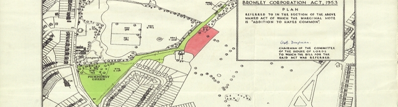
The claim relates to five applications made in 2004 by a third party, Mr Stuart, to record on the definitive map and statement for Dorset, five byways open to all traffic (BOATs) — public carriageways, all of them probably unsealed, but which are mainly used by walkers and horseriders. The TRF and David Tilbury took over the applications. Now, the Wildlife and Countryside (Definitive Maps and Statements) Regulations 1993 provide, in regulation 2 as applied by regulation 8(2), that the map which must accompany an application “shall be on a scale of not less than 1/25,000”. It’s worth noting here that the regulations are not a model of good drafting, and moreover, neither in the regulations nor in the enabling legislation (Paragraph 1 of Schedule 14 to the Wildlife and Countryside Act 1981) does it say that the map must be an Ordnance Survey map — even though Schedule 1 to the Interpretation Act 1978 helpfully defines what is an ‘Ordnance Map’.
Mr Stuart’s applications contained maps generated by PC-based software published by Anquet derived from Ordnance Survey mapping at 1:50,000 (or ‘1/50,000’, using the slightly quaint form of the 1993 regulations), but enlarged to a scale of 1:25,000. The question before the courts below, and now for the Supreme Court, is whether such an enlargement of a smaller scale map renders an application compliant with the legal requirements of the 1993 Regulations and paragraph 1 of Schedule 14 to the 1981 Act? The point of specifying a minimum scale is that the application route can be reasonable accurately determined in relation to its surrounding features, such as whether it runs on one side or the other of a hedge — only the 1:25,000 mapping and larger scales show hedgerows, fences and walls. On the one hand, an extract of England from a World Atlas could be enlarged to 1:25,000, but would clearly lack any useful identifying features of any kind. On the other, given that the legislation fails to require the use of an Ordnance map, a sketch drawn at 1:25,000 would appear to be compliant, but very likely would be a good deal less useful than the enlarged 1:50,000 map produced by Anquet software.
At this point, the reader might legitimately ask whether the question before the court really merits consideration by that court, the Court of Appeal and the High Court. After all, Dorset County Council was at liberty to waive the non-compliance with the regulations, or revert to the applicants for a compliant map. While the question itself may appear of limited relevance, the answer holds the key to the future classification of the application and other BOATs. This is because s.67 of the Natural Environment and Rural Communities Act 2006 extinguished rights for motor vehicles on most unrecorded public carriageways. But subsection (3) contained an exception for such ways which were the subject of an application to record as a BOAT, where the application had been made before 20 January 2005 (the date on which the Government’s legislative intention was announced), and the application was “made in accordance with paragraph 1 of Schedule 14”.
The Court of Appeal has already held, in R (on the application of Warden and Fellows of Winchester College) v Hampshire County Council, that ‘in accordance with’ meant in strict compliance with the requirements of paragraph 1. That judgment has meant that many subsisting applications to record BOATs have failed to attract the protection afforded by s.67(3), and at best, will now be recorded as restricted byways (at worst, the applicants will lose interest in pursuing the applications, and the applications may be lost altogether). The TRF case will now decide whether applications which were otherwise compliant, but which submitted a map not produced directly from an Ordnance Survey 1:25,000 map, are also deemed to be non-compliant, and have therefore had motor vehicular rights extinguished by the 2006 Act. That then, in this and potentially similar cases, is why the question has been escalated to the Supreme Court, and accepted by it for determination.
In the Court of Appeal, the court recognised that, in the absence of any specification of an Ordnance map in the 1993 Regulations, an applicant could submit a map at a scale of 1:25,000 which showed more or fewer features than an Ordnance map at the scale, and therefore the Anquet enlargement could hardly be criticised as insufficient. Paragraph 1(a) of Schedule 14 to the 1981 Act requires the submission of “a map drawn to the prescribed scale” (i.e. the prescribed scale of 1:25,000), and the Court of Appeal thought this satisfied by the Anquet software ‘drawing’ the map when it was printed out. But it is not hard to conceive that the Supreme Court may conclude that the Anquet map was ‘drawn’ at 1:50,000 when it was published by the Ordnance Survey, even if printed at a larger scale, if that will preserve some unsealed roads in the countryside from the perceived curse of recreational ‘off-road’ vehicles — much the same motivation which influenced the Court of Appeal in Winchester. It will be a few months yet to find out.

Hugh,
Has the decision of the Supreme Court been published? In my view it is the scale at which the map data is surveyed which is the determining factor. Now that OS mapping data is all digital it is easy to enlarge data surveyed at any scale to display it at the enlarged scale without it displaying any obvious signs of being enlarged. In the days of photocopied enlargements the scale increase was obvious from widened linework and courseness of presentation.
Wouldn’t it have been nice for the relevant laws to have stated that the mapping must be Ordnance Survey mapping as published at a scale equal to, or larger than, 1:25,000.
Hi David A — yes, the judgement is here. The court decided by a majority that the submitted map was compliant. That was probably the right call, because a Google map extract at 1:25,000 would surely also be compliant, despite containing potentially no useful information whatsoever.
The failure of the relevant regulation to specify use of an Ordnance map is all the more surprising, because that regulation relates not only to applications for orders, but also the definitive map itself.
Hi David, yes, the legislation is behind the times, but the 1993 Regulations were deficient even when published, in failing to specify an Ordnance Map. I’d guess a court would be happy to say that a map published (in printed form) by the OS at a particular scale is indeed compliant with a requirement to use a map at that scale, even though, for example, the 1:25,000 map is basically a photo-reduced version of the 1:10,000 map (put another way, one could argue that a 1:10,000 map shows no more detail than a 1:25,000 map). But the absence of any requirement to use a particular type of map does, to my mind, fatally undermine the intent of the 1993 Regulations. If the Supreme Court upholds the judgment of the High Court, then ironically, the applicants would have been quite alright to submit some sketch maps at the relevant scale, but not (as they did) to submit enlarged 1:50,000 Ordnance Survey maps of considerably superior accuracy.
In this context, the scale of an OS map is not as straightforward as looking in the margin. Historically OS maps have been surveyed at large scale, say 1:2500, and reduced in order to produce a 6″ County Series sheet, say. Does that mean it was ‘drawn’ at 25″ or 6″? If we say it was drawn at 25″ is that altered by the fact that some features were removed during the reduction process for the sake of clarity. Nowadays the question makes even less sense when much is done electronically – the scale could depend on the level of magnification (hold Ctr and scroll the mouse wheel) or even the physical size of the screen being used. In the old days, if the mapmaker’s eyesight was poor he used stronger optical magnification but the scale of the map remained the same. Now (s)he can instantly adjust the scale of the map being worked on. Not unusually, the law is several steps behind.