Blog Image

PannageMan

About this blog

An occasional blog about commons, village greens and rights of way. New posts will be tweeted at @PannageMan. Any views expressed here entirely my own. Full index to blogs: http://www.craddocks.co.uk/pannageman/index.htm.

A diverting story

Rights of Way Posted on Sun, 11 December 2016 15:23

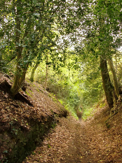
The diversion of public highways, and particularly public paths, is commonplace. Path diversions are generally made by administrative order under s.119 of the Highways Act 1980, or s.257 of the Town and Country Planning Act 1990: the procedure is relatively inexpensive, and usually successful (if success is equated with the order being confirmed). Even before s.42 of the National Parks and Access to the Countryside Act 1949 first conferred such administrative powers on highway authorities, it had always been possible to divert a highway (of any description) by an order of the magistrates’ court (and still is, under s.116 of the Highways Act 1980). So it is that many highways which exist today have been diverted at some point in their history. Sometimes, that diversion may have taken place so long ago that no record exists of the diversion, and no available map is sufficiently old to show its former alignment (but perhaps a slightly sunken track by an old hedgerow may suggest the original way today). More often, in relation to public paths, the highway authority will have diverted the way after the definitive map and statement was drawn up in the 1950s.

But what if a path, recorded on the definitive map as a public footpath, and diverted under s.119 of the 1980 Act, turns out after the event to host ‘higher’ rights than those recorded? What is the effect of the order on those rights which were latent at the time of the order, but unrecognised?

Surprising to report, there seems to be no authority on the question. In Brand & Brand v Philip Lund (Consultants) Ltd, an action which successfully proved (at least between the parties) that Ramscote Lane in the Chilterns was a public carriageway, HH Judge Paul Baker QC notes that:

‘an order was made diverting the track so that it now runs round the edge of the wood. The order was made under the Highways Act 1959 section 111, which is now the Highways Act 1980 section 119. …By adopting the plan in the statement of claim, Lund Consultants appear to accept the efficacy of this order as regards the route of any vehicular way it may be able to establish. I have had no argument on that particular point.’

At that time, s.119 conferred powers to divert only a footpath or a bridleway, and indeed, the order made by the council referred to a bridleway. However, in discussion between the bench and counsel after judgment was handed down, it was realised that, if an order was to be made declaring a vehicular right of way along Ramscote Lane, it was necessary to decide whether the right of way existed along the original way, or the replacement way following the diversion. The judge concludes that:

‘the common-sense of this is that, once there has been a diversion, whatever rights there were over the road are diverted. Just a quick look at the relevant section of the Highways Act would seem to show nothing that precluded that view.’

It seems that counsel for Lund was denied an opportunity to make further representations on that point later at a resumed hearing later in the day, but as his client got his declaration of a vehicular right of way over the replacement way, he might not have been too disappointed about that (although the width of it was tight: 6ft at one point). So the vires of the diversion order was not seriously challenged by any of the parties. Which is a pity. For, so far as I am aware, this is the only reported case even to touch on the question. In due course, following the trial, the ‘bridleway’ became shown on the definitive map as a byway open to all traffic throughout: you can see here where the byway now follows the edge of the wood where it formerly passed through adjacent fields.
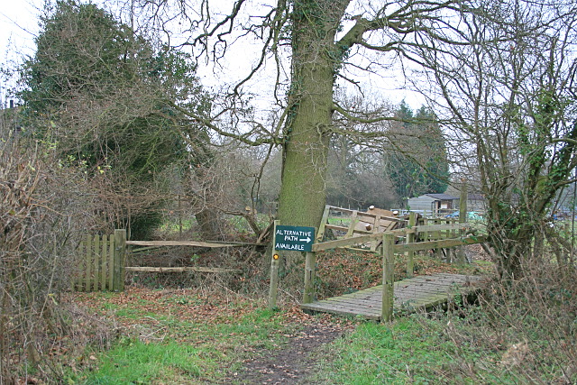
Public footpath along Tenchleys Lane, near Limpsfield Chart, Surrey.

The public footpath formerly followed the course of the Lane through the gate to left and through the garden of Tenchleys Barn. Following a recent diversion, it now follows what, at the time this photograph was taken, was marked as an ‘alternative path’. What if Tenchleys Lane were now proven to be a bridleway? In fact, an attempt to demonstrate just that failed in 2015 (see Pannageman’s report).

For any way with unrecorded higher rights diverted by order so as to expressly address only the recorded rights, there must be at least five conceivable outcomes (in this exploration, I refer to the original way as such, and the diverted way as the replacement way):

  1. The order is effective, and unrecorded rights are lost. The order stops up the original way (of whatever status), and creates the replacement way of the status set out in the order.
  2. The order is effective, and the replacement way is of the status of the unrecorded rights. The order stops up the original way (of whatever status), and creates the replacement way of the same status commensurate with the unrecorded rights formerly embodied in the original way.
  3. The order is effective, but unrecorded rights are preserved. The order stops up the original way only so far as provided in the order, but the higher unrecorded rights are retained along the original way. The order creates the replacement way of the status set out in the order.
  4. The order is effective, but only so as to create the replacement way. The order does not stop up the original way, and creates the replacement way of the status set out in the order.
  5. The order is ineffective. The original way continues to subsist, and the replacement way has no legal status (unless, perhaps, it has been in use for so long that it is deemed to have been dedicated).

None of these options is a particularly attractive one to apply to every possible case, which is why it is hard to formulate principles which can be universally applied. That is not to say that a court should or would adopt principles tailored to the particular circumstances — it ought to be possible to discern some general principles which would apply in every like case. But the approach which a court might apply in a case which comes before it might well be influenced by the circumstances — even though the legal principles, enunciated in that case, but applied in a similar case with different circumstances, might produce unfortunate results.

Let’s illustrate these circumstances with three examples, each of which contemplates the diversion of a footpath subsequently discovered, thanks to historic evidence, to be (or at least, to have been) a bridleway. First, consider a way which is diverted out of a cross-field alignment so that the replacement way runs along the farm drive. In these circumstances, there is no practical reason why the replacement way, a farm drive, should not serve as a bridleway instead of a footpath.

What if the original footpath were diverted to pass through a new housing estate, so that the replacement way were designated with a width of one metre, and were enclosed by two metre high panel fencing on both sides? In these circumstances, the redesignation of the replacement way as a bridleway would be highly unsatisfactory, being of insufficient width to pass two horses. Yet the original way might now be lost under the housing development, and incapable of being resurrected. Practicality (from the landowner’s perspective) desires that the higher, bridleway, rights, should have been extinguished without replacement.

For our third example, imagine a footpath which is diverted out of a farm yard and onto an elaborate detour around the farm buildings, on a narrow alignment with a width of less than one metre, and several stiled crossings of farm access routes. As in the second example, the replacement way is entirely unsuited to use as a bridleway: it is indeed physically impossible to use it as such, and there is no warrant to dismantle the stiles which are lawfully set out as limitations in the diversion order. But, much as the farmer might regret the resurrection of the original way through the farm yard, it is still physically practicable to pass that way, even if it is not particularly welcome to the farmer.

So a court could hardly help but be influenced by the circumstances of a case which comes before it. What of the legal principles which it should apply?

In every case, an order has been made that purports to divert a way which is not as it is described. That constitutes one inevitable defect in the order, which is a failure of description, but there is a second possible defect, which is an absence of powers. If a public path diversion order is made by a local authority under s.119 of the Highways Act 1980, the authority has a power to divert by order any public footpath, bridleway or restricted byway (the last owing to amendment of s.119 by SI 2006/1177, r.2 and the Schedule) in accordance with the requirements of the 1980 Act. What if the original way turns out to have been a carriageway over which rights for mechanically propelled vehicles endure (in effect, what might properly be recorded as a byway open to all traffic)? The authority has no power to divert such a carriageway. The order may have been duly advertised, processed and confirmed, but it remains that the order purports to do what the authority has no power to do. Will a court, advised of the error long after the date of confirmation, leave such an order undisturbed notwithstanding that it was, and remains, blatantly ultra vires? In R (Andrews) v Secretary of State for the Environment, Food and Rural Affairs (generally referred to as Andrews 1), the High Court was eager to rescind an unlawful award of a public path in an inclosure award made nearly two centuries earlier, on the ground that the inclosure commissioners had no power to make the award. That decision was subsequently overturned, over twenty years later, in Andrews 2 (see Pannageman’s final comment on the case), but only on the ground that the commissioners did have the necessary powers: the Court of Appeal left undisturbed the finding of the original court that it was proper to revisit the question of powers after such a long elapse of time. Would an ultra vires public path order be equally vulnerable to rescission? Para.4 of Sch.2 to the 1980 Act (applied by para.5 of Sch.6) provides that, after the expiry of the six week period for statutory challenge, an order may not, ‘be questioned in any legal proceedings whatever’ — but there was a similar ouster clause in Andrews 1. It must be said that the question of the ultra vires exercise of powers by public bodies could, and does, fill a substantial part of a legal text book, Andrews 1 cannot be considered, by a long way, the final word on the subject, and I do not intend to explore the point further here. But it is a vexed question surely because, whatever the circumstances, it is unattractive to apply the same rules in every one of a substantial number of highly diverse cases.

Usually, however, a public path diversion order will not have purported to extinguish rights for mechanically propelled vehicles. Far more likely is that the rights addressed in the order are within the scope of s.119 (i.e. the original footpath is subsequently discovered to be a historic bridleway or restricted byway, or the original bridleway is subsequently discovered to be a historic restricted byway), but the order is defective in adverting to the original way as only a footpath or bridleway (as the case may be). In such a case, the order is defective, in that it purports to extinguish something inferior to the true status of the original way, and to set out a new way which is equally inferior. But this time, there is no doubt that the authority had a power to divert the way according to its proper status, even though it did not properly exercise the powers, nor invite objections on that basis. And while the order is defective, the legislation seems to make the position clear: s.119(1)(b) provides that the council may, by order, ‘extinguish, as from such date as may be specified…, the public right of way over so much of the path or way as appears to the council requisite as aforesaid.’ This provision does not provide for the extinguishment of whatever is specified in the order (be it a footpath, bridleway or restricted byway), but the extinguishment of the ‘public right of way’. A court might find the comprehensive scope of that provision seductive in determining the effect of the order on previously undiscovered higher rights.

But there is no compensating solace in s.119(1)(a). This enables the council, by order, to ‘create, as from such date as may be specified in the order, any such new footpath or bridleway as appears to the council requisite for effecting the diversion’. There is no flex in those words to infer that, despite the authority’s error in specifying the creation of a footpath, the legislation has actually operated to create a bridleway (or a restricted byway, as the case may be). My belief, albeit on fairly meagre provision, and in the absence of a compelling set of practical considerations to direct the court to a different conclusion, is that, provided that the order could lawfully stop up the original way, it will be taken to have done so — and that the replacement way will be precisely as specified in the order, and no more.

Of course, different legal mechanisms may lead to different outcomes. If the way was diverted by order of the magistrates’ court under s.116 of the 1980 Act, the magistrates had undoubted power to divert and stop up any highway, and I would conclude that, even if the original way was described only as a footpath or bridleway, but was subsequently established to be a carriageway for all vehicles, the order will be taken to be effective in the terms described in the order.

But that is to decide only between the first two of the conceivable alternatives set out earlier in this blog. What of the other three? In my view, they are conceivable alternatives — but barely so. Alternative three contemplates the designation of the original way as a class of highway unknown to the common law: a bridleway over which there exist no rights on foot, or a restricted byway over which there exist no rights on foot, and perhaps no rights on horseback or on cycle (depending on the terms of the diversion order). Such highways are not entirely alien: motorways and some roads subject to traffic regulations orders are prohibited to ‘inferior’ classes of traffic — but these highways have been so designated for coherent reasons. I find it impossible to imagine how a bridleway available to horse riders but unavailable to pedestrians could make sense. If, however, one conceives that the original way endures without any restriction on the classes of traffic which may use it, then that is alternative four… .

Alternative four is superficially more attractive from a public interest perspective: the original way is found to endure, as does the replacement way. But it has little support from the legislation, nor from logic. The landowner will suffer a ‘triple whammy’: once the error has been identified, not only is the original way resurrected long after it was purported to be extinguished by order, but it is now found to carry higher rights than previously manifest — and the landowner is also lumbered by the replacement way too (it will be small solace that the replacement way has only the status set out in the order).

Alternative five might be equally acceptable to the public: the order is deemed to be of no effect whatsoever. Given that the order was defective (we assume here it was not wholly ultra vires), that might not seem unreasonable — but flaws in the procedural process do not necessarily void the action taken by a public body. And in terms of practical realities, it is perhaps the outcome least likely to make sense, in that the original way may long since have been developed on the assumption that it has ceased to exist, and the public will have used the replacement way as if they had a right to do so. Indeed, throwing open the replacement way for public use might be taken to amount to common law dedication of a right of way, were it not that in the ordinary course of events, the order expressly creates the right of way. In Powell and Irani v the Secretary of State for Environment, Food and Rural Affairs and Doncaster Borough Council (reported by Pannageman), the court found that a way which had been used by the public long after it had been diverted elsewhere, had come into being through presumed dedication, even though the landowner might have assumed he had no power to interfere with use of the way because it was still shown incorrectly on its original alignment on the definitive map. So alternative five might, in many cases, be indistinguishable from alternative four: both may lead, after a sufficiently long interval, to the establishment of public rights over both the original and replacement ways.

If this analysis turns out to be correct, it has significant implications for research to identify and record, on the definitive map and statement, under-recorded rights of way. For if the candidate right of way was previously diverted with only the status then apparent, it may be that any application to ‘upgrade’ the way cannot succeed, at least in respect of the original way stopped up. Given how widespread is the diversion of public rights of way, this may be a significant impediment to such research.

Restoring the record in East Kent

Rights of Way Posted on Fri, 11 November 2016 11:32

Those who have ventured from the Pannageman blog into the web pages mentioned in About the author opposite may have stumbled upon the ‘Applications‘ suite of pages. This reflects a personal interest in rights of way research, and catalogues a number of applications, and draft applications, to add to the official record various unrecorded public rights of way, and in one case, common land, largely focused on East Kent. I’m sometimes asked what inspired me to embark on research in this area, given that I live in Surrey. So here goes.

I’ve always been fascinated by Britain’s rights of way network, and a keen walker and rider. But rights of way research — researching, documenting and applying for the recording of public paths which escaped the creation of the definitive map of rights of way in the 1950s — is a more recent interest. I first got involved in identifying the historic character of a route in Fetcham, Surrey, which I and others from our livery stables had ridden for years, but had lately attracted criticism from some locals because of its recorded status as footpath. Research in the late 1990s demonstrated that the ‘footpath’ was an old road, part of Kennel Lane, which had been eclipsed by development of housing, and escaped being tarred in the industrious period between the two World Wars when most public roads were visited by the tar painting gang. The county council compromised by obtaining an order from the magistrates’ court to stop up the road subject to bridleway rights, and today, the route is recorded as a public bridleway.

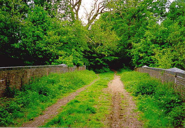
Unsealed former carriage road bridge on Kennel Lane, Fetcham

Fast forward to the present decade, and I embarked on some research on the Hampshire and Berkshire border, near Bramshill, to identify two restricted byways (carriageways over which rights for mechanically propelled vehicles have been extinguished) in an area where my sister lives, and which I have frequented on many walks and a few rides over the years. Two applications for these restricted byways to be recorded on the definitive map were made in 2013: these and subsequent applications can be viewed here.

In 2013, a friend who had been walking in East Kent ventured down the minor road to sequestered Knowlton village to view St Clement’s church, a redundant church under the care of the Churches Conservation Trust. The Ordnance Survey Explorer map at that time (and still, at the time of writing), showed the continuation of Knowlton Lane past the church as a ‘yellow road’ for about 100 metres — usually a good indication of public status, but the visitor was confronted by a sign which read ‘Private: No public right of way’. Knowing that I’d be interested in the contrast between map and reality, he passed on the details.

It didn’t take me long, even from desk-top research, to conclude that there was something missing from the map. A little east from Knowlton, beyond the end of that ‘yellow road’, the Explorer map shows a public footpath, beginning at the parish boundary, east towards Thornton Lane; moreover, the Ordnance Survey marks the way ‘Black Lane’ — as it has ever since the first large scale map was published in 1872. Enquiries to the county council revealed that, when the definitive map was drawn up in the early 1950s, there was confusion about whether the way between St Clement’s church and the parish boundary was a public road, which did not need to be recorded on the definitive map, and the parish of Goodnestone did not claim it. Over the years since then, research has shown that Black Lane is an old road or bridle-road of some significance, frequently referred to in the C18 as the main route between Canterbury and Deal. An application for Black Lane to be recorded on the definitive map was made in 2015, with 39 pieces of evidence (though some of the C18 maps are distinctly unhelpful).

At that time, I concentrated on researching the background to Black Lane (and the background is voluminous: the tally of 39 has now reached beyond 50). But the nature of rights of way research is that one thing leads to another. As one trawls the archives, it is impossible not to notice clear indications that the status of other ways has been under-recorded (typically, roads or bridleways as footpaths), or that such ways have been omitted altogether. As an example, the tithe map of Eastry, across which Black Lane runs, shows Black Lane as a distinct track or road. But it also marked two other ways as ‘bridleway’ — one of which is not recorded on the definitive map at all, and one of which is recorded only as a footpath. Such evidence is not conclusive of the status of a way as a public bridleway: it might be argued that the tithe map was not drafted with the purpose of identifying public paths, or that the bridleway was no more than a private right of way (though private bridleways are a rare thing outside inclosure awards). It does, however, inspire further research in pursuit of corroboration.

Black Lane, Knowlton, between Thornton Lane and the dismantled East Kent Light Railway. Of the 2,930m applied for, this short stretch is the only (barely) accessible part — on foot.

Over several years, I have acquired perhaps 25GB of maps, documents and registers covering the former Eastry rural district council’s area, from visits to the Kent County Archives, the National Archives, the British Library and the Canterbury Cathedral Archives. All four have been hugely helpful, and I am also grateful to the British Horse Society’s Kent area for reimbursing my expenses in gathering the data, and Phil Wadey’s and Sarah Bucks’ Restoring the Record for guidance. The consequence is that it is now possible to form a preliminary view on the historic case for any particular way in that area, on the basis of desk-top research drawing on data already accumulated. These data are never the full story: it is often possible to identify further historic documents specific to a particular parish or manor. An estate plan or parish map may provide key evidence, and this will still require additional visits to the archives. But the key building blocks for an application are in place. I have made four applications for ways in East Kent at the time of writing. Three more are in the pipeline, and others may follow.

I was asked by a friend whether I thought about the landowners whose land these ways cross. All of the ways applied for to date cross agricultural or grazing land: in my view, acquiring land brings with it responsibilities as well as benefits. Land has always been subject to often hidden obligations: both private and public rights of way, other easements, rights to light, rights of common and other profità prendre, even the obligation to maintain the chancel of the church or to maintain a public road. These obligations have been pared away over recent years: some of them must now be registered by the beneficiary against the registered title to the land, while the scope to enforce unregistered easements is now somewhat more restricted than previously. But public rights of way, even those not recorded in the definitive map, are not entirely hidden: a cursory look at historic large scale Ordnance Survey maps (now available on-line) will reveal many apparently public paths which, if sufficient other evidence exists, may be the subject of a future application. Consultants are available who will carry out more detailed research for a fee, in anticipation of a prospective purchase. To date, none of my applications has intruded on ‘private space’: a home or its immediate grounds — but even if one does in future, new powers available to local authorities under the Deregulation Act 2015 will enable authorities to negotiate with landowner to agree a diversion order (known as a modification consent order) as part of the recording process.

Why were these paths not recorded on the definitive map? The Dover Express and East Kent News for 4 August 1950 records a parish meeting in Adisham to discuss the parish survey to inform the new definitive map. The report says that:

‘A large map of the Parish was closely scrutinised, showing 13 footpaths and 12 bridle roads. Each path and bridle road was dealt with individually, and, of 13 paths, it was agreed that 7 were necessary, 2 necessary for part of their length and that 4 no longer had any useful purpose. Of the 12 bridle roads, 7 were considered to be still serving a use [sic] purpose, 2 for part of their length and 3 were considered of no use whatever.’

It remains to be seen whether, in fact, those 3 or 5 bridleways ‘considered of no use’ in 1950 were indeed excluded from the definitive map. What was considered useless in 1950 is not necessarily useless today (and vice versa). But the sentiments of the meeting are not likely to have been unique to Adisham.

Research is now up against a deadline. At the end of 2025, most unrecorded public footpaths and bridleways will be extinguished under Part II of the Countryside and Rights of Way Act 2000 (CROW). Were it not for the CROW cut-off, it might be that many unrecorded paths would have been quietly forgotten. But the cut-off, sought by the landowning and farming bodies as a quid pro quo for the right of access granted by Part I of CROW, gives new impetus to identifying these unrecorded routes. And there are only nine years left.


The withered arm

General Posted on Tue, 05 July 2016 10:11

Debbie and I acquired a horsebox about eight years ago. It opened up many new opportunities to explore the Surrey countryside on horseback, riding our two horses. One of the hacks which quickly became a favourite circuit is based on the rough parking area at Albury green (actually part of Albury Heath). Most riders who come here, whether from local stables or, like us, in a horsebox, then head west down Sandy Lane and up to the many sandy paths on Blackheath, which is indeed rewarding.

But we soon ‘discovered’ a more diverse ride to the east. It takes us over Shere Heath, down the deeply incised Dark Lane, over two fords on Chantry Lane and the delightfully narrow Rectory Lane, through the heart of Shere village (teeming with visitors on bright weekends), east towards Gomshall, then up Tower Hill Lane — another sunken lane doubtless of great vintage — and down Jesses Lane before heading west again along cross-field bridleways, descending down an enclosed path to Hound House Road, up to Parklands, across the bridle crossing over the railway at Shere Heath, and back to Albury Heath. We come this way perhaps once every month or two: the land is well drained, and the paths a pleasure in every season.

Dark Lane Copyright Stefan Czapski and licensed for reuse under this Creative Commons Licence.

Or at least, we did. Yesterday’s ride demonstrated the long term impact of successive years of cuts to the county’s rights of way budget. Whereas, when we first came this way, paths might have got cut three times a year, now there are funds sufficient for only one — and that’s true of most paths in the county. Tackling vegetation just once a year is always going to be far from sufficient: if the contractors arrive late in the summer, that leaves users to press through the entire growth of the spring. While if a vernal cut is done, much will regrow during the summer, and passage may well remain restricted even through the following winter. Horse riders are particularly disadvantaged by overgrowth:

  • horse and rider are taller than walkers, up to about 2.75m, but contractors may not be paid, bother, think, or notice, to clear above head height,
  • whereas walkers might use a stick or secateurs to deal with overhanging vegetation, it’s not so easy to do that on horseback, and could set off the horse where careful progress is most required,
  • horses are as susceptible to, and averse to, nettle stings and bramble scratches as humans, but have no means to insulate themselves (such as thick trousers or an unfurled map!) — see this posting on Facebook for what can happen [Facebook login likely to be required],
  • low branches or projecting brambles are hazardous: the horse has little sense of any obstruction above its own height, and the rider must watch out for him or herself — else the rider may be injured or knocked off.

Over the last ten or fifteen years, the bridleways, lanes and indeed many roads we have been riding have been getting narrower and more hemmed in. This is because the use of contractors on diminishing budgets has established a cycle of decline.

Each contractual period, firms bid for the cutting contract on price. Once the contract is awarded, they have no incentive to perform on specification, and will do the minimum that is necessary to permit passage (at least, on foot). The contract will provide for a minimum width, but will not take account of the character of the path, so each year, the vegetation on the outer edges of the path becomes better established and closes in. After a few years, saplings growing in the margins become trees, and can only be removed with a saw, which would add time and cost to the performance of the contract, so they are left. Those trees project branches over the path, or lean into the path to draw light, which narrows what is left for the user (and creates more work for contractors in future years: but that will be some other contractor’s job). The council has no wish to demand compliance with even the limited contract specification, because to do so would push up bid prices in future — and the council cannot afford to pay more. So each party turns a blind eye to the specification. Ways which were once broad lanes become narrow paths, and even if cut to specification, allow for little more than the profile of a horse rider in the days immediately after the work has been done. Three months later, however, or after heavy rain weighs down all the branches, it is very different.

And so it was yesterday. We are familiar with Tower Hill Lane, an old sunken bridleway heading south out of Gomshall, as a steady uphill trot for the horses, but no more. Nettles infest the first thirty metres, while endless low branches on the lower section make it unwise to pick up any speed. The top part has always been a bit narrow, but now, the combination of brambles, bracken and holly made it all but impassable: had it been physically possible to turn round, we would have done. I had brought a pair of secateurs with me, but it is hard to do more than remove the most threatening strands which are suspended provocatively across the path when you’re mounted. The outcome was a left arm covered in scratches, horses’ flanks covered in nettle stings, and an £80 new pair of breeches looking like they’re fit only for mucking out.

We can, and will, report the overgrowth to the council. The rights of way team has recently lost three officers and has a huge backlog of unfulfilled reports. Even if there is someone to act on the report, there probably won’t be any budget to deal with spot problems, and these paths will have to await their annual cut. We don’t know when the cut will take place: it could be this week, or it might not be until the end of the summer — or it might have already taken place, and that’s it for this year. I’m not sure even the council officers know, individually, which path is cut when: that may be a matter of considerable discretion for the contractors (which will also save money). So we have no idea when it might be sensible to return, although a visit during the winter might be more realistic. Instead, perhaps we will head west in the future, along with all the other riders, and ride over the unenclosed tracks on Blackheath instead.

Some will say that a few overgrown paths impassable to horse riders is no big deal at a time of searing cuts to public services. Yet these are paths in one of the most popular areas for rural recreation in England: about 40km from central London, easily accessible to millions, hugely popular for walking, cycling and horse riding. If paths in the Surrey Hills are becoming difficult to use, what can we expect in the more remote parts of England (to find out, try reading Catriona Cook’s day 8 blog of the Journey for Access from Dartmoor to the New Forest)?

After the ride

And if motorists think that they’re immune from such trials, don’t be so sure. Just the same cuts are being made to road maintenance budgets, and in the same way, many roads have their vegetation cut just once a year. Trees have become well established in the verges and hedges, many roads have become enveloped in walls (and often ceilings — try a double deck bus route in the countryside) of greenery, and we have greatly increased the costs of future maintenance by reducing expenditure in the short term. Try taking a delivery van down some of those minor roads which we road last weekend, such as Chantry Lane, and you’ll find it’s not just horses and riders that end up with scratches. On some roads, even motorists struggle to avoid the overhanging brambles and branches, and this will continue to deteriorate.

A concluding thought: last year, Chantry Lane, which apart from being a useful road for walkers, riders and cyclists, also serves two cottages, was resurfaced. There was nothing particularly bad about the state of the road before, but the highways authority, like many others, receives additional, ring-fenced funding (Surrey receives nearly £1m in 2016–17, now virtually the only grant paid for specific purposes) for resurfacing roads. So it is that the council can afford to resurface a truly minor road to some cottages — but it cannot find the funds to keep the high, roadside banks from closing in over the smart new blacktop.


The end of prescription on commons?

Common land Posted on Tue, 10 May 2016 16:38

The judgment of the Court of Appeal in Littlejohns and Littlejohns v Devon County Council and the Duchy of Cornwall, handed down on 6 May 2016, tries to settle the vexed question of whether rights of common can be acquired by prescription after 1970, over land which was already registered common land. It’s best to start with the background in my previous blog, where you may, if you wish, also read about the judgment in the High Court.

The appellants, Mr and Mrs Littlejohns, were fortunate, in both this court and below, to have Nicholas Le Poidevin QC acting for them: Mr Le Poidevin is the former deputy Commons Commissioner with considerable experience in this area. But in the event, by a two-to-one majority, the Court of Appeal has upheld the judgment of the High Court, and found against the appellants. Accordingly, subject to any appeal to the Supreme Court (and the brief report on the Landmark Chambers website states that permission to appeal was refused by the Court of Appeal: it could still be granted on an application to the Supreme Court), the law is that no rights of common can have been acquired by prescription over registered common land since 1970, and any commoner who (as did the appellants) continued grazing after 1970 without having registered any rights of common, cannot point to any legal authority for doing so.

The appellants’ circumstances are not unique: this case was taken as far as the Court of Appeal not least because there are others who are seeking to resolve precisely the same point of law applicable to their own circumstances. Some of them may have pending applications with the defendant authority, or another pioneer commons registration authority, to register other rights of common said to have been acquired by prescription in the same way. There are surely a good number of commoners who exercise ‘rights of common’ which are founded in long-standing practice originating with previous generations, but, for some reason or other, the rights were not properly registered under the Commons Registration Act 1965 (‘the 1965 Act’). And there will be others who do not seek to justify their grazing in long-standing practice, but nevertheless have increased their grazing activity beyond what was registered under the 1965 Act, and now hope to acquire permanent recognition for it through prescription. Last week’s judgment ensures that they will be disappointed: indeed, in some cases, the judgment could threaten the viability of upland holdings where the farmer has come to rely on the use of those rights.

The Chancellor of the High Court, an ex officio judge of the Court of Appeal, Rt Hon Sir Terence Etherton, gave the dissenting judgment, and in my view, gets it right, so we will start with the Chancellor. Much of the Chancellor’s judgment includes a summary of the background and statutory provisions (paras.1 to 34) and the judgment of Lang J in the High Court (paras.35 to 48). In his overview of the appeal (paras.51 to 72), the Chancellor gives considerable attention to the recommendations of the Royal Commission on Common Land, reporting in 1958, and how the 1965 Act followed, but also departed from, its recommendations.

The Chancellor observes that the defendant authority’s case relies on the abolition of prescription by the 1965 Act. He says (para.76) that such a significant change to property rights ought to be effected by specific words, and focuses on s.1(2) of that Act, which is the only provision to which such consequences could be attributed, but he finds no such words present (para.77). Nor were there any words of comfort in the Parliamentary proceedings on the Bill in Hansard (para.78). Even the Commons Registration (New Land) Regulations 1969, which provide for the registration of new rights of common under s.13 of the 1965 Act, fail to explain why an application cannot be made to register rights over existing common (para.79).

If s.1(2) does not abolish prescription, the Chancellor considers whether s.1(2) has the effect that a right acquired by prescription is abolished at the very moment when prescription matures into a right? This would be after 20 years prescription, based on a ‘lost modern grant’ — the legal fiction that the prescriptive practice can be attributed to a former grant made by the person prescribed against (in this case, the owner of the common) which has since been lost. But he finds that s.1(2)(b), which extinguished unregistered rights of common, applies only to rights already in existence in 1970 (para.81) — were it otherwise, here too the effect would otherwise be to abolish prescription without clear words to that effect (para.82).

The Chancellor derives (para.83) some comfort from the date set by order at 31 July 1970, as the date on which unregistered rights of common were extinguished under s.1(2)(b). If the intention was that s.1(2)(b) should apply to all rights, whenever created, rather than those capable of being registered by the closing date for applications for registration under s.4 of 2 January 1970, it should have had effect on any right created after it became too late to register it, on 2 January 1970, and not on 31 July 1970 [though in my view, this may pay too much respect to those who drafted the SIs].

The Chancellor notes the argument (para.84, also expressed in my previous blog) that there is a circularity between s.1(2) and s.13. If we think of s.13 in relation to new rights of common acquired over previously unregistered land (an unlikely scenario these days, but let us suspend scepticism), the new rights become registrable under s.13 after 20 years use as of right (on the basis of a presumed lost grant). [He does not say, but it might be put like this: if s.1(2) has continuing effect, those rights, supposedly maturing on the last day of the 20th year, are immediately extinguished “unless they are registered”. Is the commoner to register them at the stroke of midnight on that last day of the 20th year, before s.1(2) does its worst an instant later?] Accordingly, the Chancellor finds (para.86) that s.1(2)(b) extinguishes only rights which existed and were capable of registration on or before 2 January 1970, and inevitably, that s.1(2)(a) (which deems unregistered land to be neither common land nor town or village green) has similar effect (para.85). In other words, the Chancellor thinks that s.1(2) has a ‘big bang’ effect, wipes the slate clean of anything which could have been registered prior to 2 January 1970 but was not registered (commons and greens could however be registered by the registration authority on its own protective initiative up until 31 July 1970), but has no further continuing or prospective impact. He notes (para.85) an oddity if s.1(2)(b) has continuing effect: s.1(2)(a) cannot have the same continuing effect, else no land could ever become common land, and s.13 would be largely redundant.

The Chancellor recognises (para.87) that the 1965 Act was, at least so far as common land and rights of common are concerned, a staging post to comprehensive legislation, and it is not necessary to ascribe to the 1965 Act an intention of establishing a ‘conclusive and comprehensive register’ which had to await further legislation under the Commons Act 2006 (‘the 2006 Act’). Interestingly, the Chancellor identifies a now oft-forgotten objective of the Royal Commission: to provide for improvement and agricultural intensification of common land where appropriate. That is not to say that the Commission wanted to resurrect the inclosures, but it did not view all commons with a dewy-eyed perspective of preservation. The Chancellor quotes (para.57) the Commission’s report: “…we assume that, given the right circumstances, commoners who have pasture rights will generally endeavour by the better stocking of their common to attain the same level of economic production that has been achieved by the rest of the agricultural industry…”. The Chancellor is convinced (para.88) that the 1965 Act was not intended to fly in the face of the Commission’s perspective, by removing the mechanism of granting new rights (whether by prescription or express grant) over a registered common. And he finds nothing in the 1965 Act nor the 2006 Act which interferes with his conclusions.

The Chancellor also observes that s.13 did enable amendment of the registers to take account of a variation in a registered right of common, and considers that such a variation could embrace an enlargement of the right (para.89): there was “quite simply no discernible reason” why the 1965 Act should have allowed this, but turned its face against the grant of new rights. The Chancellor accepts the widely-held belief that the 1965 Act was poorly drafted, and concludes: “the 1965 Act should be interpreted so far as possible to give effect to a coherent policy, consistent with the objectives of the Royal Commission”.

But the Chancellor is in a minority. Lewison and Tomlinson LJs do not agree, and as a majority, they find for the defendant authority.

Lewison LJ opines that the 1965 Act was intended to establish definitive and conclusive registers. He refers (paras.113 to 114) to the report of the Royal Commission in pursuance of that objective [which undoubtedly is what the Commission intended], and (para.115) to the explanatory notes to the 2006 Act, which says, “The 1965 Act was intended to establish definitive registers” [my italicisation: it is in any case quite worrying if judges are going to pray in aid quotations from Explanatory Notes to Acts, given the minimal effort put into writing them nowadays]. But the judge admits (para.117) that, “the Act did not precisely implement all the Commission’s recommendations”, and quotes Mr Le Poidevin describing it as ‘half-baked’ (para.124). Lewison LJ finds (para.132) that s.1(2)(b) simply extinguishes any unregistered right of common which would otherwise be exercisable over registered common land. He thinks (para.137) that, were it otherwise, the system of registration established by the 1965 Act would be “all but pointless”. He relies for support on Lord Hoffmann in The Trap Grounds.

[I would say that the 1965 Act was not intended to be the last word in registration — it took another 40 years to achieve that. As for the Trap Grounds, the courts accepted that the provision in the 1965 Act for the registration of greens was somehow different, and final: there was no need for further legislation (were it otherwise, we would still be waiting for a legal right of use of new greens registered under section 13): Lord Hoffmann said (para.48, Trap Grounds): “It is by no means clear that Parliament contemplated further legislation about rights over village greens.” He did not suggest for a moment that the same conclusion would be justified in relation to common land, and rights of common.

Lewison LJ accepts that the 1965 Act did not compel amendments to the registers to keep them up-to-date, so undermining the argument that the registers were intended to be conclusive. So he takes comfort from concluding (para.139) that, “at least the register will reflect the maximum burden to which the registered common is subjected” [but not if the Chancellor is correct that a variation under s.13 might increase the burden]. He refers to the anomaly that a farmer who has an express right granted in 1955, but fails to register the right, would have lost it for want of registration in 1970, and by 1975 would have nothing to show for his 20 years grazing. But a neighbouring farmer who started grazing in 1955 as of right would have acquired a (non-registrable) prescriptive right in 1975, and would be better off than his neighbour who relied on the express grant. Apart from the odd discrimination between these two farmers, it gives rise to a legal anomaly: the neighbour’s claim to a prescriptive right relies on a lost grant made on or before 1955. If such a lost grant really did exist, then it was indeed registrable in 1970, and must have been extinguished for want of registration. The Chancellor, in his judgment (para.96), got round this by asserting that a claim on the basis of prescription could therefore not rely on any use prior to 1970 (it would have to be 1970 onwards to at least 1990); Lewison LJ, not unreasonably, criticises that approach as putting a gloss on the legislation which is not there.

[This is valid criticism: but the lost grant is indeed a legal fiction, and legal fictions regularly lead to legal anomalies. In Bakewell Management Ltd v Brandwood, cited by Lewison LJ, the House of Lords decided that a lost grant of a right of way across common land could be inferred from 20 years’ use despite use of the right of way being illegal without the landowner’s consent. This leads to the very odd anomaly that for 20 years, the user is committing a criminal offence, but on the last day of the twentieth year, not only does the user become lawful, but apparently, the previous criminality is erased, for the law now assumed that the user was done with the benefit of a ‘lost grant’ made at the start of the 20 year term. Can the user get a pardon for past convictions?]

Lewison LJ is not impressed with arguments that his finding allows for interference with property rights without clear words in the legislation. He says that the 1965 Act clearly did interfere with property rights [i.e. in general terms, those of commoners and landowners]; prescription itself interferes with the landowner’s property rights; landowners may, if they wish to expressly grant rights in the face of the court’s finding, do so by granting a leasehold term which is not registrable and therefore not affected by s.1(2)(b) [but would such a right be exercisable competitively alongside other commoners with ‘real’ rights?]; there is no interference with the landowner’s other interests, such as to grant easements [this hardly seems relevant]; in promoting the Commons Bill in Parliament, the Minister accepted that there was controversy over whether prescriptive rights could still be created [indeed — but this is, as I commented in my previous blog, agnostic evidence: Parliament was leaving it to the courts to decide]; and the Royal Commission wanted no further claims in respect of registered commons [leaving aside whether the Commission’s recommendations were given proper effect, one questions whether the Commission had in mind claims which could not even be made at the cut-off date for registration]. Lewison LJ concludes that, “If Mr Le Poidevin is right then the [1965 Act] register is virtually useless”.

[Well, quite so. In my view, that is why further legislation was contemplated by the Act itself, and passed in 2006. It’s just that, in 1965, no-one contemplated that it would take 40 years for new legislation to polish off the work commissioned by the 1965 Act. Indeed, Ministers said at the time that it would take Commons Commissioners five years to sort out the disputes engendered by provisional registration under the 1965 Act — but it was not until Mr Le Poidevin himself determined the final case in 2010 that this work was done. If the drafters of the legislation thought it would all be sorted out by 1975, and further legislation would follow, then it was of little matter if interim legislation had only interim effects. The judge asks: “why did Parliament prohibit registration of new rights of common over common land registered under the 1965 Act, if it did not intend that they should no longer be capable of acquisition?” That would be a good question, if it were correct. But it isn’t. True it is that the 1965 Act did not confer powers to register such rights. But it was only r.3(2) of the Commons Registration (New Land) Regulations 1969 which prohibited registration. Attributing to Parliament an intention in secondary legislation subject only to negative resolution goes too far.]

Tomlinson LJ agrees with Lewison LJ, briefly citing eight points which have proved decisive:

  • the intention of the 1965 Act to establish a definitive register (albeit one not conclusive of extent of common land);
  • the natural meaning of s.1(2), that after 31 July 1970, unregistered rights of common were not to be exercisable;
  • the reference to ‘any such land’ in s.1(2)(b) over which such rights were no longer to be exercisable was intended to mean registered common land;
  • s.1(2)(a) referred to “no land capable of being registered under this Act” but s.1(2)(b) referred only to “no rights of common shall be exercisable”: it therefore did not distinguish rights which were capable of being registered under the Act;
  • s.13 was concerned with land which became common land after 31 July 1970;
  • r.3(2) of the Commons Registration (New Land) Regulations 1969 properly gives effect to the scheme of the parent Act;
  • the 1965 Act did intend to effect the prospective abolition of prescription for rights of common, in line with the intentions of the Royal Commission; and
  • the alternative approach subscribed to by the Chancellor would involve an anomalous treatment of rights acquired by lost modern grant.

In my view, the Chancellor, in his judgment, gets under the skin of the 1965 Act and better understands the scheme of that Act — to the extent that it had a scheme. Nevertheless, unless there is an improbable appeal, the matter has now been decided. One can only wonder what will happen to the Littlejohns’ grazing activity on Okehampton Common and the Forest of Dartmoor. The court has decided that their grazing can have no lawful origin. Yet the landowner, the Duchy of Cornwall, has taken no part in the proceedings. Will the landowner, or any commoner (we cannot now rightly call the Littlejohns ‘commoners’), take action to exclude the Littlejohns from grazing on the commons — even though they, and their father, have been grazing the commons for decades?

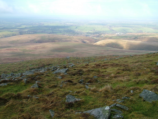
Okehampton Common: Copyright David Brown and licensed for reuse under this Creative Commons Licence.

The judgment can also be seen with brief comment from Landmark Chambers: Stephen Whale of Landmark acted for the defendant authority.


The Somerford case: highways and village greens

Town and village greens Posted on Tue, 22 March 2016 11:15

There was a time, in the first few years of the present century, when it seemed that town and village greens were in favour. There was a steady flow of new applications to register greens, the courts (including in several high-profile cases before the House of Lords) had made rulings supportive of such applications, and the Commons Act 2006 re-enacted, with modest concessions, legislation to facilitate such applications.

The high tide mark was the 2010 ruling of the Supreme Court (as it had then become) in R (on the application of Lewis) v Redcar and Cleveland Borough Council and another, which decided that, where users of the land claimed as a green had politely deferred to the landowner’s members playing a round of golf, so as to avoid disrupting the game, that was no more than the give-and-take customary in the British way of doing things, and did not suggest that the user was any less than ‘as of right’ — and that once the claimed land (Coatham Common, the name ‘common’ in this case not signifying that the land was already registered common land) had been registered as a green, the rights of the local community to use the green for lawful sports and pastimes would remain subject to the same principles of give-and-take.

Since then, the tide has predictably ebbed under pressure to promote development and growth, and political and judicial support for registering new greens has declined, with the provisions in the Growth and Infrastructure Act 2013 greatly restricting the scope for registering greens in the teeth of development plans, and several decisions of the courts imposing constraints on what land may be registered.

Yesterday, 21 March 2016, the Administrative Court of the High Court handed down a useful judgment in R (Somerford Parish Council) v Cheshire East Borough Council and Richborough Estates Ltd (I have altered the listing to conform to the usual practice for judicial reviews: if any reader can tell me why the parties in this and some other cases alight on what appears to be a non-standard form, please do add a comment below) which, while hardly suggesting that the tidal ebb has cycled back to a flood tide, does clarify some interesting points on the relationship between greens and highway rights, and the obligation on commons registration authorities (which determine most applications to register greens) to deal with applications fairly to all parties.

The case was about an application by Nicholas Bell to register the verges of two minor roads in Somerford, west of Congleton, as greens: Chelford Road and Black Firs Lane, under s.15 of the 2006 Act. It seems that the application (as so often) had something to do with a proposal to develop much of the land between the roads. It is not suggested that the verges themselves would be incorporated in the development (although parts fell within the development site, and were excluded from the application under s.15C of the 2006 Act, inserted by s.16 of the Growth and Infrastructure Act 2013), but their registration as greens would have seriously constrained access to the development site. You can see the two roads west and east of the arrow on Streetmap, generously proportioned by the Ordnance Survey, and get an idea of the character of the land from Google Street View here and here. Those who refer to Street View will see that both roads have a very broad verge planted with trees, and those inclined (like me) to jump to conclusions will assume that the roads were historically wide, and perhaps inclosure awarded. Not so: a quick look at old-maps.co.uk shows that the roads, while not ungenerously proportioned on the Ordnance Survey 1909 County Series 1:2,500 map, had both acquired substantial verges and apparently new outer hedges by the time of the 1965–67 map.

The challenge by way of judicial review was essentially one of procedural flaws to the determination of the application by the commons registration authority, Cheshire East Borough Council (a unitary authority), brought not by the applicant for registration, Mr Bell, but by the parish council. The registration authority had appointed James Marwick, a barrister who specialises in village green cases, to act as an inspector to consider and advise on the case. Frequently, that role includes presiding over a ‘non-statutory’ public inquiry (‘non-statutory’ because there is no statutory requirement on the authority to hold an inquiry) to hear and test evidence from all parties. But in this case, Mr Marwick identified that there was a key objection to the application: were the verges part of the highways? And if he could conclude in the affirmative, he might not need to proceed to an inquiry.

It seems to have been accepted by the court that, if the verges were highway, then the application must fail, because the claimed activities of lawful sports and pastimes carried out on the application land were generally no more than people had a right to do in exercising reasonable use of the highway, and could not amount to use ‘as of right’ for the purposes of claiming a green. There have been several cases in the courts over the years which have tried to distinguish user of land which may establish public rights of way, and user which may support a claim to register the land as a green, but (to to the best of my knowledge) none has found that a green cannot be claimed on existing highway land. (Although many registered greens do include highway land, not least because, whereas s.22(1) of the Commons Registration Act 1965 excluded highways from the definition of what could be registered as common land, it was not excluded from the definition of greens). The court’s position is hardly surprising: the House of Lords in Director of Public Prosecutions v Jones and another (a splendidly liberal decision led by the then Lord Chancellor, Derry Irvine, when Lord Chancellors still participated in all three parts of Government, viz the executive, legislative and judiciary) found that a demonstration on the verge of a main road was not a trespass exceeding the rights of the user, and greatly extended the prevailing historical interpretation of what amounted to reasonable user. It seems that the claimant had sought permission to challenge the decision in Jones all the way up to the Supreme Court, but leave had been refused on this ground (see para.6, though one wonders whether the Supreme Court might have risen to the bait given the chance).

Mr Marwick received considerable evidence from the defendant authority on the status of the verges, some of it after the deadlines he had stipulated for submissions from parties. Mr Bell, the applicant, did not specifically ask for an extension of time to comment, on the late submission nor was one offered, while Mr Marwick, in his report to the council, said the late submission was: “relatively incontrovertible documentary evidence and having considered it in detail, it does not significantly alter the Council’s position or my view of the issues in this matter.” In the event, the court disagreed, noting that much of the late-tendered evidence was new and capable of being challenged, and Mr Bell ought to have been offered an opportunity for that purpose. Given the critical question of whether the verges were highway land, the authority’s decision to refuse the application without affording such an opportunity was flawed, and was quashed.

As a procedural failing, the case might not be thought to offer much of interest. But it does.

First, one of the grounds of challenge was that the registration authority “act[ed] as Judge in its own cause and thereby in breach of natural justice”. The authority was said to have an interest in promoting the development on the adjacent land and releasing the funds committed through a s.106 agreement. The claimant said that authority should have asked another (presumably neighbouring) authority to determine the application under s.101(1)(b) of the Local Government Act 1972. The court found against the claimant on this ground, with some inconclusive consideration of previous caselaw (including the rather odd case of R (Whitmey) v the Commons Commissioners), but concluding (para.31) that, “appointing an independent legal expert to conduct a non statutory enquiry and make findings is an appropriate mechanism.” And indeed, the court went on to find (para.74) that there were sufficient disputes of factual issues raised to require the inspector to hold a public inquiry.

Second, having decided that there was a procedural failing, the court was bound to consider, under s.31 of the Senior Courts Act 1981 (as amended by s.84(1) of the Criminal Justice and Courts Act 2015), whether: “it appears to the Court to be highly likely that the outcome for the applicant would not have been substantially different if the conduct complained of had not occurred.” This required the court to appraise the potency of the claimant’s arguments that, had Mr Bell been afforded an opportunity to challenge the late evidence, it might have undermined Mr Marwick’s conclusion that the verges were highway land.

The court’s analysis demonstrates that the origin of the wide verges was somewhat uncertain, but at least partly attributable to an inter-war initiative by a predecessor highway authority to widen the roads, perhaps in anticipation of road improvements. The documentation was incomplete and, at least in the claimant’s view, inconclusive. It was not entirely clear under what powers the land had been acquired, whether all the land had been acquired (or the landowner had voluntarily resiled from its use), whether, insofar as it had been acquired, it had immediately become dedicated as highway land by virtue of statute, and whether the authority had maintained all the verges itself (or frontagers had maintained some of them).

A point was taken on documentation which showed, in any event, that the roads, including the verges, were included in the authority’s ‘list of streets’, a list of publicly maintainable highways which every highway authority is required to keep under s.36(6) of the Highways Act 1980 (it was apparent that the ‘list’ was in fact a map). Mr Marwick had advised the authority that the inclusion of the verges in the list had “not been challenged. This is strong evidence in itself that the land is highway land.” Mr Bell had argued that inclusion in the list of streets was not conclusive evidence of public highway status, and was “no greater than the evidence upon which it is based.” The court accepted, “that the plan showing the list of streets is strong evidence that the land is highway land, though not determinative.” There was a presumption of regularity about the list. But as the list was not the only evidence, and serious questions had been raised about its accuracy, the claimant was “entitled to explore the question of what, if any, evidence supports it.”

Mr Bell, and Somerford parish council, will now get a new opportunity to pursue the application, presumably through a ‘non-statutory’ public inquiry. If they succeed in contesting the evidence of highway status, they will still need to show that there was sufficient use of the land as of right for lawful sports and pastimes during 20 years preceding the application to justify registration. But if the application is granted, any plans which the highway authority formerly or now, or indeed the developer, had to use some of the land for road improvement or access to the development site, will have to be reviewed, with the possibility of further delay and costly provision of exchange land in order to release it from designation. Somerford parish council is not destined to be remembered in quite the same way as Sunningwell parish council, but for a relatively rural and sparsely populated parish outside the built-up area of Congleton itself, this was quite an achievement just the same.

Postcript: On reflection, even if the application land were found not to be highway land, the question arises — for what purpose was the land acquired by the council, and was use of the land by local people ‘by right’ or ‘as of right’? In R (Barkas) v North Yorkshire County Council and another, Lord Neuberger said (para.24), “where the owner of the land is a local, or other public, authority which has lawfully allocated the land for public use (whether for a limited period or an indefinite period), it is impossible to see how, at least in the absence of unusual additional facts, it could be appropriate to infer that members of the public have been using the land ‘as of right’, simply because the authority has not objected to their using the land.” It is by no means inevitable that success on the narrow highway status point will secure the outcome that Somerford Parish Council seeks.


« PreviousNext »